
Day 0: Lead Your Horse
At a roadside pullout I strech my back. Trucks howl past just a couple feet away, each one slamming me with a wall of sound. It’s my second day traveling to Waterton, the start of the Great Divide Trail. In 2022 I began hiking one of its seven major sections each summer.
I’m taking turns driving with mom, who lept at the chance to help. Sabrina, eight months pregnant, will pick me up in about a week.
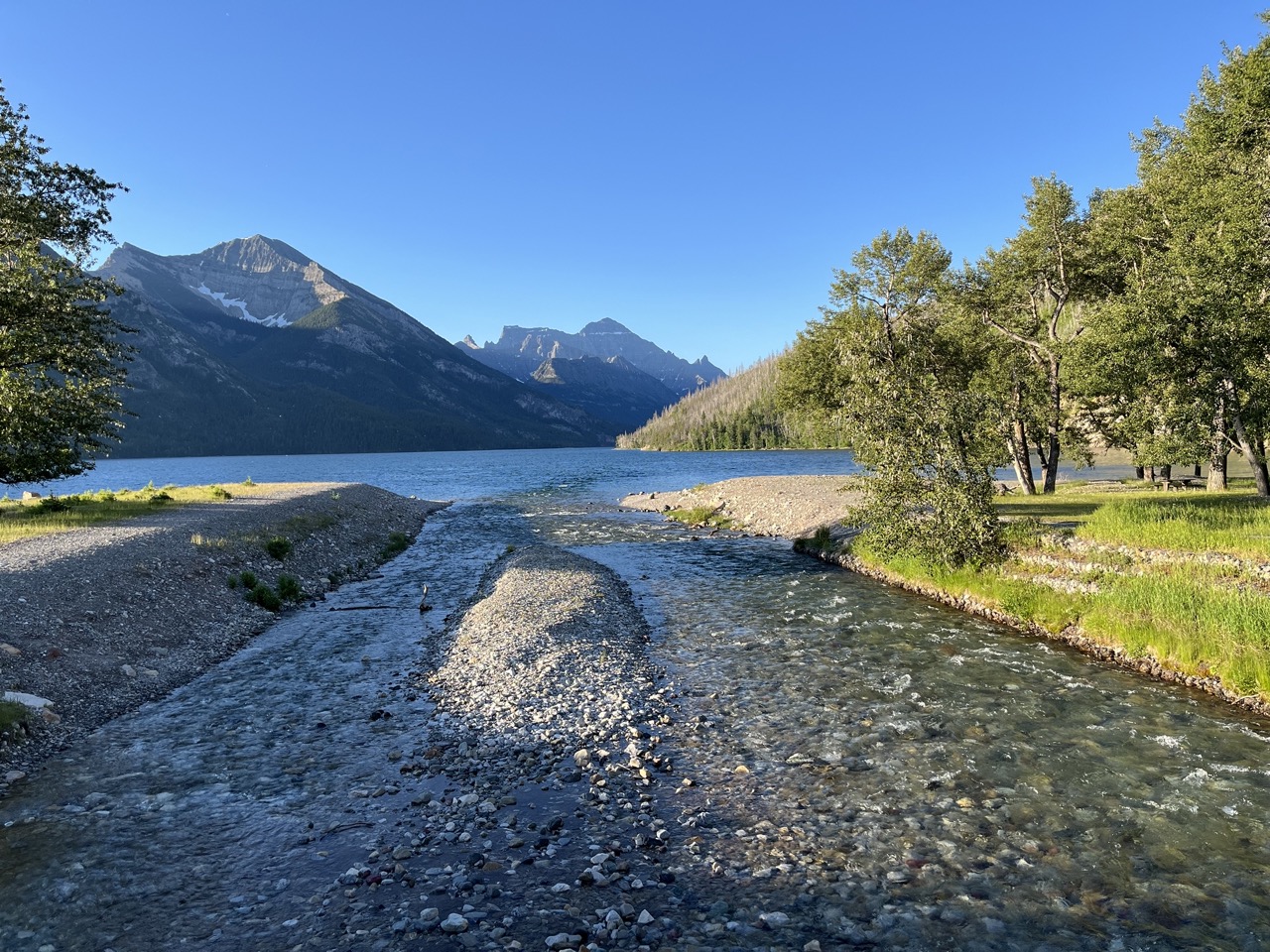
South of Calgary, we find rolling green hills, canola fields, wind farms. And suddenly the grey smudge on the horizon rears up into real mountains, shimmering through heat haze. We arrive in Waterton after lunch. The mission today is to walk to the US border and back so that tomorrow I can start north. It’s about a 13km out-and-back and I suppose it must be mostly flat since it follows the shore of the lake filling the valley. I think it will take about four hours.
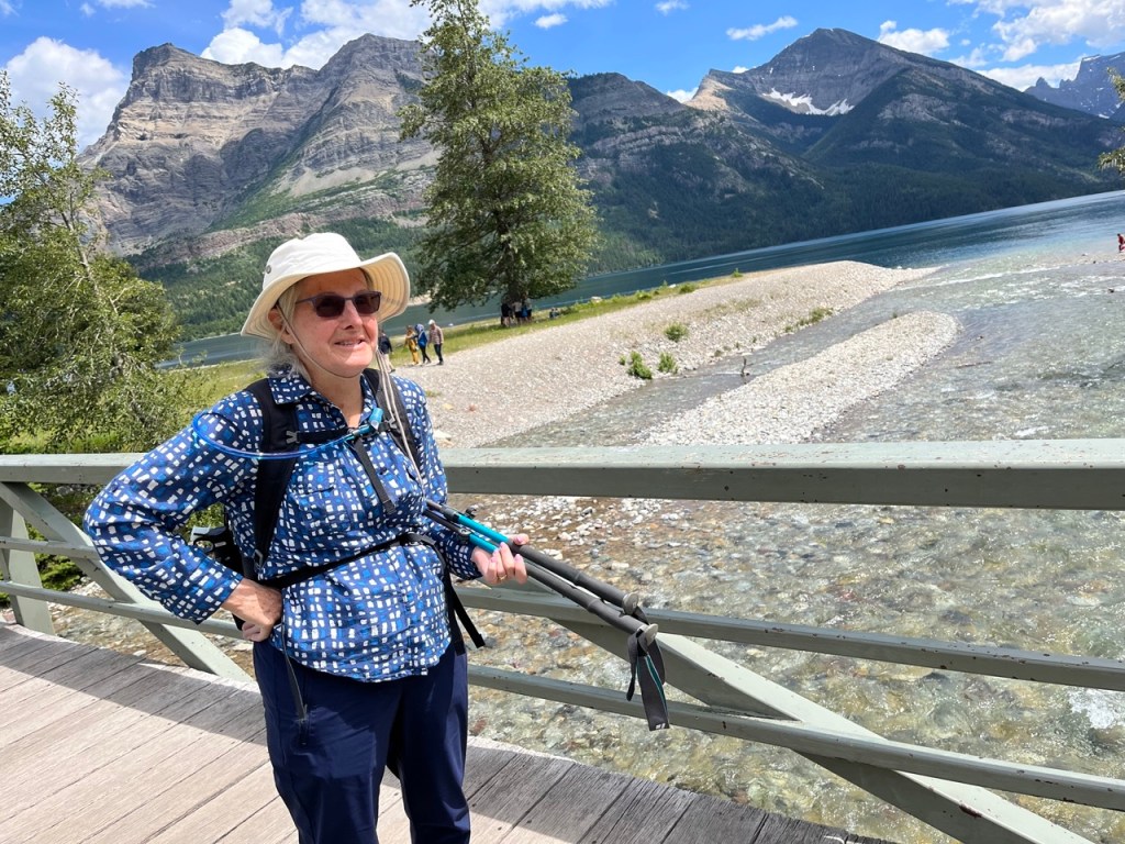
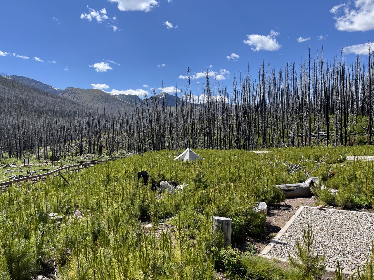
We set off just after 2pm, climbing surprisingly high into the sun-baked bluffs above the lake. The burned trees of the forest are black and silver spikes, and below them is a thicket of shrubs and wildflowers.

It’s very hot and there is no shade. Tour boats pass in endless procession, measuring the lake’s length 50, 100 times per day. We’re sweating but moving well.

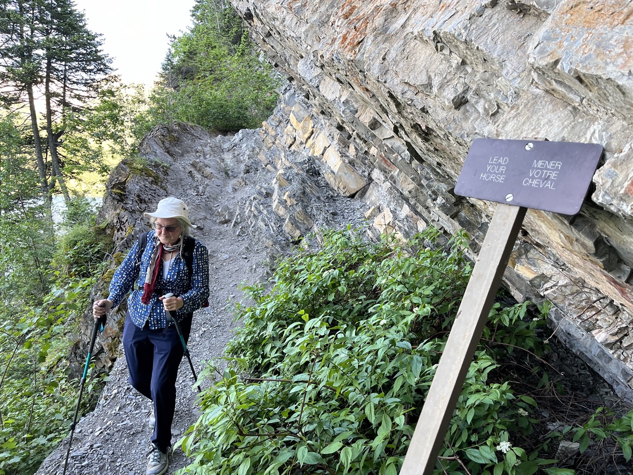
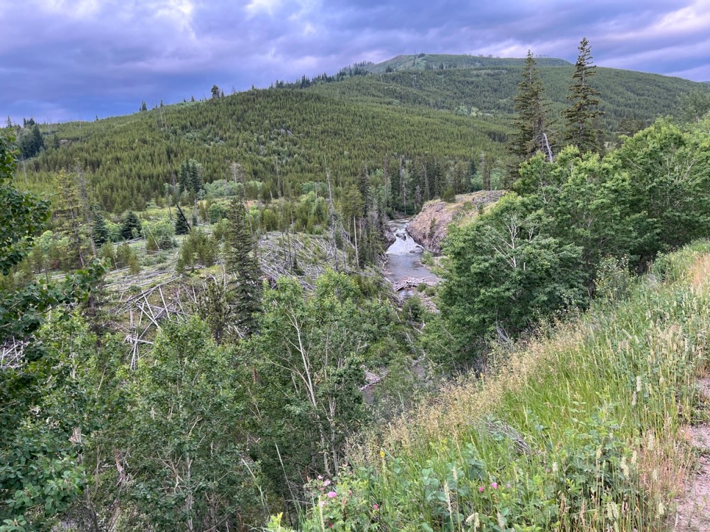
After a while the trail is squeezed by an outcrop at the lake’s edge. A sign says, “lead your horse.” A chunk has been cut from the cliff, and we must walk up a steep stone ramp. It’s over a meter wide, but the steep drop to the lake on one side and something about the view of the sky over the top triggers a panic attack for mom. I help her to the top and she quickly gets her breath back. We talk about turning around but she is determined to complete the hike.

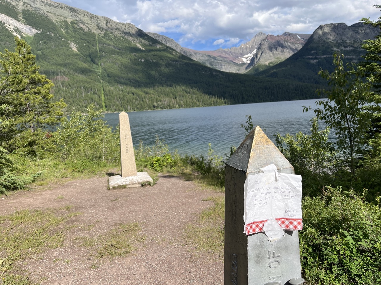
With the afternoon passing, we enter unburned forest and the shade helps but mom’s energy is flagging. Our pace drops and then drops again. We make it to the US border at 5:15. We chat with a few campers and refuel with electrolytes and bars. I see a hiker in a sun hoodie with a white ultralight pack, who I mark as a GDTer.
Somewhat rested, we start back at 5:30. I brought extra food and water, but none of my backpacking gear. We will need to make it back to Waterton tonight, even if it is very slow going. Mom guesses my thoughts and makes a concerted effort to keep a good pace. To keep achievable goals ahead of us, I recite the landmarks we had seen on the way in – first we’ll do the forest switchbacks, then the third beach, then the two creek crossings, then the second beach, then the scary rock ramp, then the last beach, and so on.
We make pretty good time and get to the rock ramp in 90 minutes. If we can get down it, I’m confident we’ll make it back without more drama. It seems very steep, and loose stones skidder down with every step. I hold her hand and we start inching down.
We’re a few steps in when her phone rings. It’s dad, wondering how our hike went. Have to call him back. This distraction has rattled her, but we continue down one hesitant step at a time. At the bottom, mom laughs tearfully. That was a very frightening thing for her, and she was already exhausted. She is a very tough person. She tells me that was nothing compared to what she did with Arlene in Israel.

It’s early July and the summer evenings take a very long time to fade into night. We can afford to take the rest of the walk slowly. She groans at every step up or down, but we hobble back to our campsite around 8pm and make dinner. Mom calls dad back and relates the adventure while I inflate her mattress. When she crawls into her tent, she is so sore she isn’t sure she’ll be able to get back out in the morning.
Day 1: Goodbye Goodbye
I don’t sleep much and it’s light by 5am. Groggy, I pack up everything I need for the week. The campground is quiet; nearly everyone is still asleep. Despite her predictions, mom feels ok this morning and accompanies me to the trailhead. On the big kiosk map, I show her my route for the day and say goodbye.
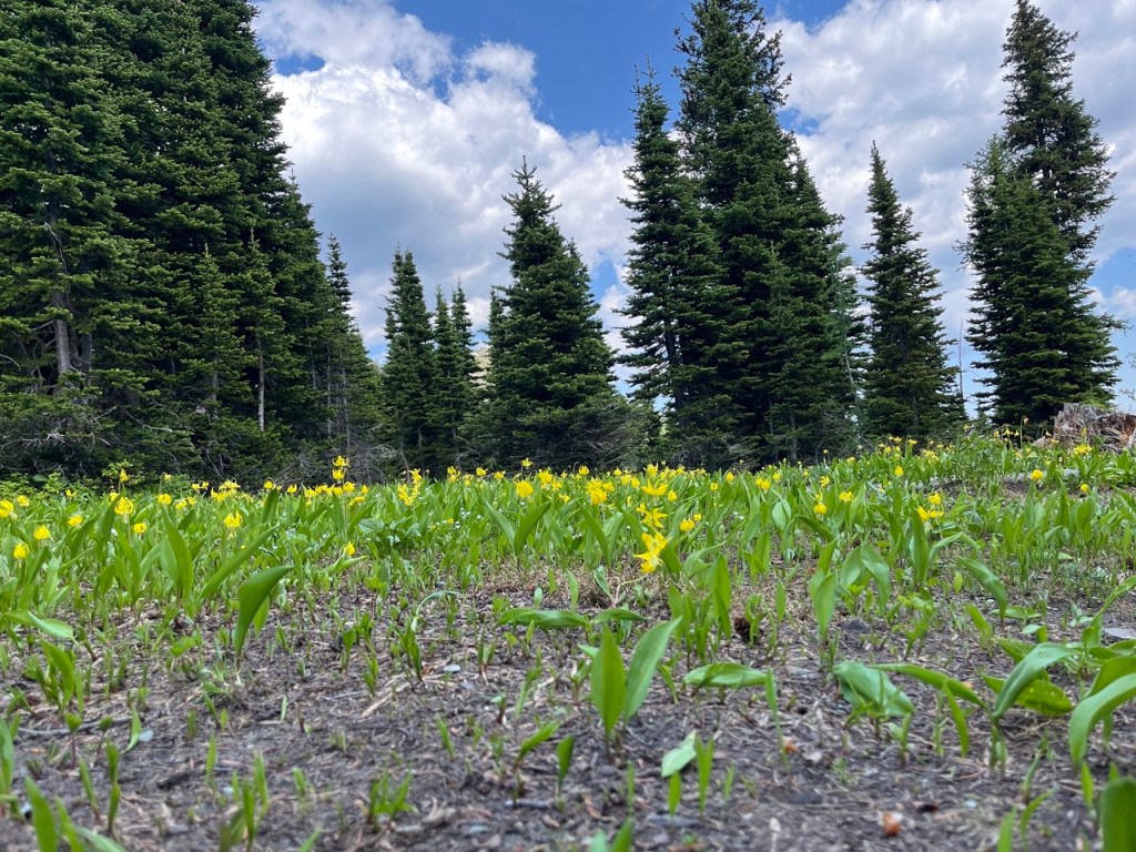
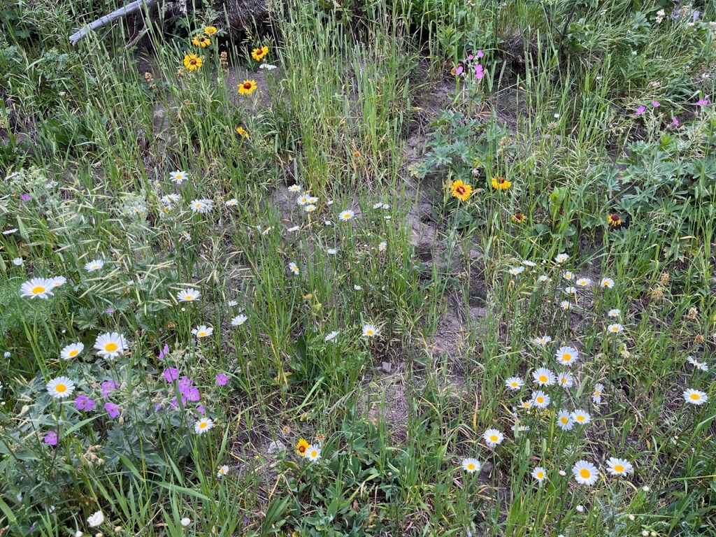
The fire that swept these mountains was enormous; I’ll be walking through its regeneration for days. But it did not touch every valley and hillside. For example, there are a couple square kilometers of forest ahead of me, a brief glimpse of what the park looked like 7 years ago. Where the fire did visit, there are no mature trees left alive. In the understory, cow parsnip grows chest-high, with Cretaceous-sized leaves and tiny white flowers. Turn the corner and you’re greeted with a crowd of purple and yellow stars. I am walking through a young land exploding with colour.

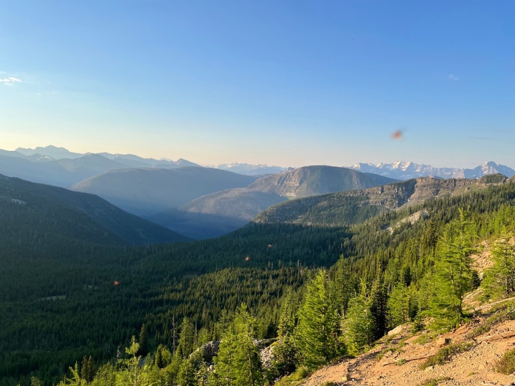
And then suddenly I turn a corner and I am back in a shady old forest. The fire somehow passed over or around this pocket of trees. It is a pleasant grove, a wood of small extent. I see a deer just off trail. And then I break into the alpine. Some trail runners pass me. I climb past waterfalls and tiny tarns, dark blue in the shade of steep walls. When I look back, the valley I’ve ascended runs straight out to the rolling fields of cattle and wind turbines, a green haze in the distance, a thousand metres below me. Lakes stretch out like sapphires on a bacelet.

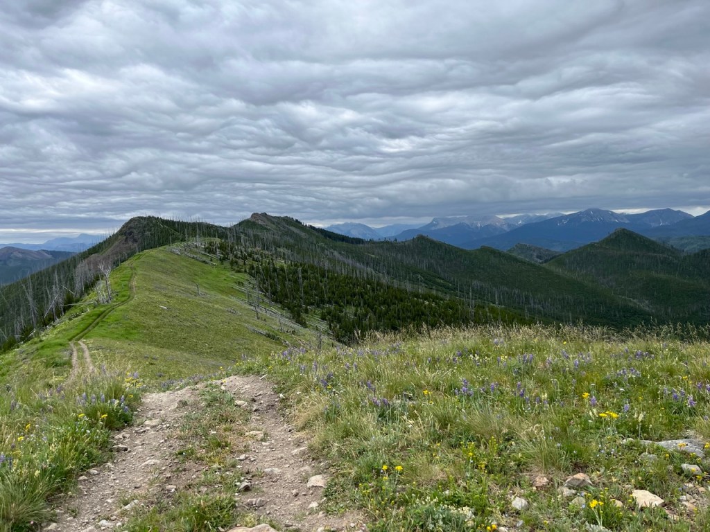
I plod higher up the shale. Now there are only a few hardy flowers to break up the tans and greys. And then I see over the ridge I’ve been gaining and a view bursts on me of the next valley. I laugh out loud, stunned. I tack on a short side trip up to the true summit of the ridge and stand on a pedestal, a world of green and grey at my feet. I have been to some places that can compete with this view, but nothing to beat it.

The day is getting hot. I start down long scree switchbacks to a pleasant lake in an upper valley. While I fill up with water, a French family discusses their plans, and I confirm that I can’t understand quickly-spoken French. The dad says hello to me in careful English and I wish to try replying in French but don’t dare.
I continue my decent. Down, down, and now the sounds of boats and beaches reach me, echoing off the amphitheater walls. I reach a busy front-country trailhead with a visitor centre, boat launch, and bathrooms. It is really hot now, and I rest and dawdle and read the informational plaques on whitebark pine. It is so hot, mid afternoon, and the last couple hours of hiking to camp are on a blacktop road and then through a shadeless burn. I consider just waiting at the lake until things cool down. At any rate, I decide to go back to the lake to fill up my water bottle, for something to do.
“Ben!”
Mom has also been loitering here, having remembered the route I showed her this morning. She drove around the mountains that I walked over, and has been strolling along the lake, apparently not overly sore from yesterday’s hike. She is excited and happily supplies me with the water I need. She offers to drive me the few kilometers up the road to the next trailhead, but I want to walk the whole section so I decline. As I start, she passes back and forth a couple times in her car to wave goodbye again and again.
Before my shoes have melted, I’m done the road walk and turn west to cross the divide for the first time this trip. There is just one small climb, but without a breath of wind, it is not pleasant. When I get to camp, I’m alone in a dense sea of baby lodgepole pine trees. I get water and it is so hot. I set up my tent and move in slow motion but everything I do makes me sweat. I walk back to a side trail I saw on the way in that had a sign for a waterfall. Standing at the bottom, soaked by the spray, I finally feel comfortable again.
When I get back to the campground, the man in the white pack that I saw yesterday at the border has arrived. We talk about our next few days and then I wander down to the creek. The sun is starting to lean to the west and the bigger tree trunks cast enough of a shadow that I can sit in some shade, and enjoy cool air currents swirling up from the creek. After an hour, I decide I can make supper now, and when I get back there are several more hikers, all doing the GDT too. A man in a grey pack is at the picnic tables with White Pack guy and we talk while we eat. At 8 it is cool enough to hide from bugs in my tent. I hope to sleep better.
Day 2: Grey Pack
I do sleep better and though I’m out of camp by 7:30, I’m the last one. My hips are a bit sore from the food-heavy pack, but other wise I’m feeling good and the cool morning lets me make good time back to the parkway. I continue up the road, already radiating warmth at 8 in the morning. Beside me the ditches are a riot of wildflowers. I dodge light traffic for another half hour, then I reach the trailhead.

Grey Pack guy is there, taking a break before starting the long climb to another summit. He is doing the full GDT and has the approved thru-hiker setup. Durston tent and pack, sun hoodie, Altra trail shoes, cold soaked meals. I’m surprised he isn’t far ahead. I start up the trail first, but he soon leap frogs me in part because I stop to take pictures of the flowers too often. He is also just slightly faster on the uphills.
I pass a family of day hikers as I reach a meadow at the bottom of an enormous cirque. The walls of the amphitheatre seem impassably steep and it is hard to imagine how a hiking trail can escape to the ridge hundreds of meters above me. It starts by switchbacking up through the last of the trees on the west side of the bowl to a grassy ledge. I stop to drink and see a faint trail through the scree ahead, sidesloping across the steep north wall of the cique. Grey Pack is halfway along the traverse, and has hit a large patch of snow. He is going extremely slowly and carefully, testing each small step, clearly unnerved. I feel confident and take a slightly higher line that skips most of the snow, and soon catch him. The path continues its arc, up the east side of the bowl now, to where the ridge is a bit lower. Now that it’s just a steep climb, he pulls a little ahead.

At the east rim of the bowl, there is a momentary reprieve. I look back and the bowl I climbed out of looks even more impressive from above. But there is still more to do. The trail follows the ridge crest back north, between precipitous drops on either side. As the ridge climbs, the trail again steepens until it reaches a small broken cliff just below the summit. The exposure on all sides and hands-on moves has again caused Grey Pack to slow down.

I would normally feel uncomfortable here too, but having someone else there helps me. I offer to go first to kick steps in the lingering snow. No, I’m ok he mutters, and he is ok. It is only a few quick moves, and then we are both on the summit high above everything we could shout at.

It is nearly as incredible as yesterday’s summit view. Beside us, on the other side of a burned valley, is a long ridge that White Pack should be walking now. I try to guess how far along it he must be. I eat and relax. When I’m done, Grey Pack is still lounging over lunch. I say so long and start down into the burned valley. It gets warmer as I descend and the afternoon sun beats down on a rock oven filled with black trees.


The flowers are again incredible. Maybe even the best I’ve ever seen. The trail goes steadily down but then repeatedly climbs steeply back up, drenching me in sweat. I reach a creek a few inches deep, dump my pack, strip, and step in. I had planned to sit down but before I do the cold bites into my feet. I try again, three or four times, and splash my body thoroughly until my body’s temperature has reset. I eat and filter more water and start a final climb to escape out of this charred valley. At a saddle I overlook my campsite at a lake. To descend I have to negotiate a modest cornice. I walk to the side to see where it is less steep and pick out a line that I can descend without risking a slide.
At the bottom of the valley, an avalanche field has created a patch for new-to-me flowers. I reach camp. I set up my tent to dry (there was heavy condensation last night) and then go to the lake. I take off my shoes and walk in up to my knees, bending over to scrub myself. One day I will dive right in, underwear be damned. I let the hot afternoon air dry my skin. I dress, eat, and write. Finally Grey Pack arrives. He still has several hours to hike, and I don’t envy his next two climbs during the late afternoon. He leaves me to the abundant horse flies. I pace slowly around to avoid them, jotting notes and trying not to start sweating again.
I have supper, take my time with my chores, wander around to look at the warden cabin, decked out in owl sculptures. I am just returning to my tent when a couple with a big fluffy dog arrives. They were supposed to stop 10km ago but, worried about a rumoured brake cable-chewing marmot, they are pushing to finish their 3 day hike in 2 days. They will have nice scenery but their trip is a hard march because they are worried over something that probably does not exist. I take the lesson for myself without comment.
Day 3: Decision
I need to pee. It’s dark. I’m too lazy to dig my normal glasses out of the my pack, so I stumble, blind in my prescription sunglasses towards the privvy. I try without the sunglasses. Still blind. I stop about 10 metres from my tent and pee against a tree. Back in my tent I start to settle in when I hear a noise from where I peed. Twig snap, soft thud, scratching.
You goddamn idiot. You goddamn idiot.

Heart racing, I hear nothing. I start to get sleepy, but the panels of my tent are lightening and morning is creeping behind my eyes. I pull my buff down low to block out the faint dawn, but it’s no use. Finally I get up at 5:30 and see a blaze of gold on the horizon. The other couple is also stirring. I eat and pack up. They emerge to start breakfast and I wave on my way out. I make good time to some lakes in the next valley. It’s deserted. I filter water and watch the fish jump. I’ve never seen fish jump. Mosquitoes swarm me, and I figure that’s what the fish are trying to nab.
By 9am the climbs are already feeling toasty. I reach a pass and I am back in the fire. A faint track on the shale slope threads through the ex-forest. I lose it once, but I retrace my steps and pick it up again. It leads to the top of the ridge. It is steep. I realize I have underestimated the difficulty of the day. This was supposed to be my easy day, designed to leave me fresh for La Coulotte tomorrow, but in adding up the climbs and descents between a few landmarks on the trail, I’ve missed probably half the total elevation change.

I keep going, riding the ridgecrest rollercoaster, hundreds of metres of unexpected ascent and descent, no shade, no breeze, the land dropping sheer away a couple steps to my right. It is fun. When it is time to leave the edge of the mountain, I slide down a snow-filled gully.


At the same time, I am thinking about where to camp tonight. Plan A is to push all the way to a wild camp at a pass just below the La Coulotte ridge. Plan B is to stop a few kilometres earlier at a more established camp site. That will add to the next day, but it is sure to have water, unlike the wild camp. Hikers reported two springs with some flow at Plan A camp, but it is not a sure bet.
At midday I am weary and warm, but I’m back in an unburned area. I reach a lovely wet meadow full of flowers. I rest and eat and chug a litre. Another steep climb and descent gets me to Plan B Camp. It is only around 1pm. The area is clearly used by horse parties. There are seats and a big fire pit. There is an abundance of water. I lie on my back in a patch of shade and feel the earth pull heat out of my body.
The air is hot in my throat. But I know if there is water at Plan A Camp, it would be better to push there today. It is only a bit over 2km away with a moderate climb up to it, not that big a deal. But the idea of finding no water, having to come back, and then take those steps a third time tomorrow is so discouraging. I lie there and time ticks by and I really can’t decide. I get up and look around. I see piles of trash in the trees, and scraps of rusting iron stoves hauled up and discarded. The camp feels much less friendly than the last rest stop and I decide to gamble on finding water at Plan A Camp.

It takes less than an hour to get there. This near a pass, and the first thing I come to are some exposed patches of flat shale among sprarse, scraggly trees for tent pads. Supposedly there is a spring downhill from here. I stop and listen but can’t hear anything. I continue a little further to a meadow to drop my pack and look for the second spring. I see a fire ring and some logs for benches. The location of the supposed spring is not obvious and I’m getting worried. I return to the exposed sites and this time I notice a faint trail leading down through the trees. A glimpse of bright green moss, shining with wet, then the sparkle of real water. It’s just a small seep, but it passes over a rock and in the fall I can slowly collect all the water I need here. It’s a huge relief.
Now the long afternoon to pass. I normally prefer to hike all day and avoid the boredome of camp but with these temperatures my day starts and ends early. For the next hour I crouch at the tiny trickle of water and just drink and filter and wash each item of clothing I’m wearing, one by one. I explore behind the meadow more and find the second spring, also still barely flowing.
I rebuild some toppled rock cairns and write in the shade and watch wisps of clouds swirl across a sky blue like a gas flame. I consider 3 spots for my tent, each with small pros and cons. It doesn’t really matter but to save something for later, I put off the decision. Bugs fly around me, landing occasionally, but I tell myself that I am becoming one with the bug. I just let them be on their way and they do not bother me.
At 4pm I take my shirt off and soak it in the spring and put it on and the cold shock makes me gasp. I scout ahead a bit to make sure I can start my big day tomorrow with confidence. I decide where to pitch my tent and finally at 5pm I feel I have killed enough time and am allowed to make supper. No one else comes to my peaceful camp.
Day 4: Crux
La Coulotte is described by many as the most physically demanding day on the entire Great Divide Trail. I fully respect the challenge, even if I think that claim should be qualified. The hardest day depends on your schedule. Some people do 50km days in Section C and E because they can’t get popular camp site permits. And by the time people get to those later sections, they will be fitter than they were here, at the start of the trail. Nevertheless, this is clearly the hardest day I’ll have on this trip.
I make a point of getting up as soon as I wake. I force down a cold breakfast and pack up as quickly as possible. Colour is only just returning to the world when I set off. Flagging tape marks a rude trail switchbacking up to the ridge. I want to catch my breath, to save my legs for the harder climbs, but the mosquitoes are too horrendous to take off my pack. I just walk slower and sip water as the ridge takes me higher. There are occasional boot marks, but no consistent trail. It’s obvious enough where to go for now, however. Up.
There are three things that make La Coulotte hard. First is the sheer volume of elevation. There is a stiff climb up to the ridge, and then six significant high points to conquor, including La Coulotte Peak itself. Second, once you leave camp, there is no water source until you finish the entire ridge, unless you are lucky and patient with snow patches. I am bringing 4L, which is about 9 pounds in the pack to begin. Finally, there is the quality of the trail. There are several points where it is not obvious how to get up or down from the high points, and goat trails decoy you to impassible cliffs. The day will be spent largely on steep scree, burning energy as it slides you a little bit with each step, and feeling unstable on the descents, full pack swaying.
I reach the first high point while the mountains are draped in sunrise gold. The air is soaked with warm light. I set my pack down and force myself to rest and witness. I start down the other side but soon come to a sheer drop. By process of elimination I find a way down via a boulder and scree staircase. In a couple minutes I’m looking up at a much larger climb. I work at it carefully, keeping my effort at a level I can sustain all day. From the top I get my first good look at La Coulotte Peak. It looks enormous. A great pyramid of reddish shale. I again have to find my way through cliffs on my descent. The third high point is smaller and easier, and by 8am I am in the saddle below La Coulotte.

I dig a cat hole among some tough conifers. I watch some Clark’s Nutcrackers visit the white-bark pine, like I read about in the plaques on day one. I reload my water bottles, eat, and take a long rest. The peak is intimidating. It looks hellishly steep from the base and I can see it is loose rock all the way. I start up, setting little goals for myself. Each step sinks into the loose shale. I consciously take slow small steps, but my breath comes fast anyway. Sweat runs down my arms, runs in my eyes, makes my pants cling. The warm dawn has become a hot morning but just when I need it most, a light breeze makes the ascent half as unpleasant as it would be if I just had to stew in my sweat. I look ahead and tell myself I can rest at that boulder. Then the next switchback. Then those stunted trees. When I reach the trees I find, hanging from a branch, an ultra marathon route marker. (It is completely insane to me that a race would come through here.) After half an hour of treadmill scree, I look back and I’m surprised to see how high I am, hundreds of metres above the saddle. I’m over halfway up.
There are intersecting boot tracks, all leading up, some more steeply than others. I’ve stayed on the most defined one, but I realise I am gradually angling to the left of the summit. One of the steeper ones to my right must go to the top. Without really thinking about it, I leave the track and make my own switchbacks straight up. The peak does not feel so far off now and I am confident. I push a little harder, take an aggresive line, forget about conserving energy. I’m chasing the summit. I encounter some large boulders. I know there must be a hiking route further to my right, but just now some hands on scrambling appeals to me and I collapse my poles and climb up.
Now I am on top, and the view is outrageous. Alberta spreads out under my right hand and BC under my left. I can see so far. I can see four mountains back, the furthest are only grey-blue ideas, as if the sky has been embossed. It is only 9:30. In a few kilometers I’ll be off this ridge. My body feels fine, if not at all fresh. I’ve got this in the bag.
My feeling of triumph flips to concern as I look at what La Coulotte has blocked my view of. I can see the trail leading off the ridge and down into the valley where I will camp. But between me and that trail there seems to be two more very large, very steep high points. Though not as tall as La Coulotte, the one in front of me looks absurdly steep, with a hideous path twisting up right at a cliff’s edge and I can’t believe it is a hiking trail. I check my bearing very carefully. Surely my route goes around that mini-peak somehow. I can’t see how. Incredulous, apprehensive, I start bashing my way down the scree flank of La Coulotte. I’ll just have to see when I get there. The descent is mostly fine, but soon becomes thick with trees that give me a taste of what’s to come. They are chest high with thin but inflexible branches that catch my pack and push me off balance on a still-very-steep slope, and force me to slow down and pick my way through.

Up close, La Coulotte’s evil little brother looks a little better (mountains always do). The late morning is more than just warm now. The sun is ferocious on my back. I have just one of my four litres of water left, hopefully enough. I start up. It’s the steepest slope of the day, a grueling staircase that sometimes winds to within a metre of a horrifying drop to my right. I feel the exposure, trying to ignore the empty space in the periphery of my vision. I have to stop and rest several times. I gip my waterbottle tightly while sipping because I can picture it dropping off the edge. The heat radiates off the dark red rock. I am starting to take smaller mouthfulls of water, to save something for later.

Because of my fear, I do not control my pace well, and my legs are very tired when I get to the top. I take a good break. It’s spectacular up here, and I’m treated to a glorious ridge walk before starting down the other side. I can see my exit ramp. As I descend, I’m already thinking of the final high point, but that’s a mistake because it is not easy to find my way down through the trees on the other side. There are many goat tracks, but the young trees have grown up and I am sometimes pushed to my left, away from the straight descent, forced to sideslope on very steep terrain. I know I’m off course, following some other fool’s track, but little cliffs and impenetrable brush keep preventing me from getting back to the intended route to the right. For much of the day, I’ve been walking with my right leg upslope of my left. I can feel this asymmetry gradually adding up and I try to add little switchbacks to reverse this when I can. Knees complaining all the way down, branches snagging, feet skidding on steep loose rock.
Now the final climb. It is not as tall and not as steep, but it is heavily treed except for a gully filled with snow. I pick my way up by any means necessary. Sometimes hauling myself hand over hand up through the forest, sometimes kick-stepping up the high angle snow slope. It’s slow, but it does eventually end, and the way down the other side is a lovely trail, gently graded and lined with wildflowers. I only have a couple mouthfulls of water left, but now I really have made it. I look back at the ridge: an intense physical struggle, more than paid for by a view so wide you can almost feel the curve of the earth at the horizon.

The descent into the valley uses an old road that starts off easy, but keeps steepening until it is plunging down on loose cobble. It’s hard on my feet, ankles, and knees. I grit my teeth and try to take my time. At least, back in a real forest, there is shade. I am out of water now. I listen for a spring that is rumoured to exist, but hear nothing. Finally the road levels out and I come to a good stream, the first in about 24 hours. I sit down in it, letting the ice cold water numb my joints and carry the sweat and dust off me. I fill up a couple litres of water, and lounge around, eating and resting while I air dry. The road is a pleasant wide trail now, fording several refreshing streams that keep my feet squishing pleasantly for the next couple hours. As I descend deeper in the valley, great walls of alder push in from either side of the path that I have to part like a series of one thousand curtains, while calling for bears over and over.
At 2:30 I arrive at camp. Over 8 hours of hiking, 6 of it absolutely full on. The easy walking in shade has restored me, and though tired, I felt I could take a rest and push on closer to civilization if this spot feels off. It’s another horse camp, but it’s a clean one. It’s mostly a lumpy meadow coated in buttercups and dwarf dogwood. I’m almost sold on it. I air out my tent and feet. I take the opportunity of testing out some powdered soap and a bidet attachment. It’s weird and not easy. Maybe with practice? I watch the butterflies flit among the flowers and think about whether I really want to trade this for camping near a resort, even if it means the chance of buying a real meal. I will stay here tonight.

I decide to cook supper on a little gravel beach at the river. The late afternoon is casting longer shadows, and in those the temperature is pleasant. As I boil my water, an old fella with a stout walking stick comes by and hails me. He’s on a little exploratory adventure, seeing if he can find a way from this valley to some lakes in the next. We give each other some information about what’s up ahead. He ends by asking if I have everything that I need. I assure him I do, and make a note to start doing that for others. He is the only person I’ve talked to since the couple at camp two days ago.

Was this the hardest day on the Great Divide Trail for me? No. In 2022 Sabrina and I had a day that felt physically harder through the Cataract Valley. It had much less elevation, but was twice the distance and had hundreds of trees to climb over, and several challenging river fords. In 2023 I had another comparable day through Banff. It had similar elevation as La Coulotte but stretched over 35km, although that section had excellent trail. But the hardest days of all were on the 2022 trip when unrelenting cold rain and horrific bushwhacking in the Maligne Valley took us to the edge of our margin of safety and we decided to bail. For La Coulotte, I had those experiences as mental preparation, I had better gear, and I had trained my legs for it. It was still very harsh, but my day had far more enjoyment than pain.
Day 5: Forced March
Cold morning. I let myself doze in the pre-dawn and take my time leaving camp. The trail is a maintained dirt road, wide and gently sloping down to the ski resort, which should have a toilet, something I haven’t had since the second campground. I’m determined to make it there for my morning giving. I am not feeling too sore and can walk quickly, but even at a fast pace it’s a couple hours from my flower meadow. I walk faster and faster. It is getting desperate as I pass holiday homes and bungalows and spot a portopotty. The morning sun has turned it into a foul sauna, but it’s still better than digging a hole.
Now I am tramping down a paved road. I find a footpath in the trees that gets me off the asphalt for a few hundred metres, but it soon returns to the road. There is a hiker lounging in the ditch. He has an Australian accent. He is thinking of hitchhiking to the campground I’m making for, because of pain in his shin. He says he is still deciding, but I think he looks pretty decided. I remember to ask, “do you have everything you need?” He does.
It’s a relief to reach the trailhead. I stop and take a good rest after the hard foot strikes and forced march. I’m just putting my pack back on when, to my surprise, the Australian catches up, having decided against hitchhiking after all. We wave. He stops for his rest and I start into the forest. It is fun to recognize plants as I walk. I decide there is enough bear food to warrant calling out. The flower cheer squad is back and an hour of sweaty climbing gets me to the ridge crest. This ends my views as the ATV track I’m following is entirely treed. But I’m feeling good and cruising. At least it’s shady and there is even the occasional breeze.
And then I see a man and a woman sprawled by a trickling stream. They are from Idaho. The woman says she is bonking hard after Barnaby. Maybe because of a lack of electrolytes – they freeze dried their own meals but forgot salt. I am delighted. I offer my extra electrolyte tabs, which they gratefully accept. I continue on, but the trail perversely lines up with the angle of the sun so there is no shade despite tall trees on either side. My feet, pummelled by the roads and now pruning up from little stream crossings, are beginning to get sore.


Eventually the ATV track spits me out onto a gravel road, and the foot soreness continues to build. I’m moving fast, eager for it to end. Pickup trucks fill the air with dust, and there is no shade from the noon sun. I stumble on in a haze of sweat and dust. I finally arrive at my front country campground, and pick a nice site in the shade. I examine my feet. One toe has a hot spot but I’ve caught it in time to prevent a bad blister. I hobble around the gravel tent site barefoot, setting up camp, letting my feet air out.
I head down to the river. A couple with camp chairs sit in the shade. On a rock out in the middle of the river, a father and son sun bathe. Both have surfer hair. I soak my feet and sit down in the river as long as I can stand the cold. While I’m drying out on the rocks, a gregarious man comes down. He knows I am doing the GDT. He also did Barnaby. He knows the Australian and the Idahoans because, he explains, they formed a “tramily.”
The gergarious man also bathes in the river. We exchange a few words, but I am longing to stretch out, so I return to my shady camp site and have a snack and lie on the picnic table. A picnic table is a tremendous luxury. It is so pleasant. There is a nice breeze and it is the perfect temperature for lounging in damp clothes. I let time pass and my mind wander. As I have every other day, I space out my little camp chores and take my time with everything. I feel so calm and comfortable with the crux of the trip behind me. Tomorrow I walk out and the thought of a town is not appealing, but I will see Sabrina and Luke and Christy and that will be very good.

After supper, I walk through the campground and see the “tramily” gathered at a picnic table. They are laughing and talking uproariously and I look away in case the gregarious man waves me over but I don’t think they notice me. I sleep well.
Day 6: Melted Icecream
Again, I take my time in the morning but, like at Waterton, no one else seems to be stirring. As I leave, I see the woman finishing breakfast at the picnic table, the rest of the “tramily” presumably still in their tents. We nod. I don’t expect to see them again. The gregarious man had seemed eager to get to town; he said they planned to skip today’s ridgewalk, preferring to pound out quick miles on the road the whole way.
It’s overcast for the first time all week. The road follows a high bank above a river, providing wide open views to the west where there are real mountain ranges less than a day’s walk away. The land I’m traveling through now is rolling and hilly.


Within an hour I’m at the trailhead, and turn onto a steep ATV track straight up to the ridge. It’s a very multiuse trail. I see tire treads, footprints, and horseshoes. There are also plenty of deer and moose tracks. I don’t see any bear prints. The trail is only lightly treed, leaving plenty of space for flowers. Because of the clouds, now looking like hammered steel, the light is moody and flat and the flowers seem to pop even more.

When the climb is done, I take a good rest. I’m trying to time my pace with Sabrina’s drive so neither of us have long to wait. I’ll do a bit over 30km today, but my pack is light, the elevation change is modest, and at least for the morning, I have cloud cover and a light breeze. I’ve just got to watch my foot soreness and proto-blister with all the steps I’ll take on hard surfaces, and steward my water supply. This long ridge is beautiful, but there is only mud, no good water.
The trail rolls on, gradually climbing, each sweeping corner enticing my feet forward like. I’m making unintentionally quick time. I catch a bit of cell service and get a message from Sabrina. She’s a bit behind schedule. I resolve to take more breaks. The clouds seem to be lifting, and I can see pale blue creeping in from the horizon. By midmorning it’s hot again, and there is only the occasional shade tree up here. Most of the older conifers are dried skeletons, but it can’t be the recent fire that I have left behind on Day 3, as there are many trees older than 7 years. Perhaps a previous fire, or perhaps an extreme drought or wind event. It’s famously windy in the Crowsnest Pass.
In less time than expected, I reach the highpoint of the ridge. The ATV track contours below it, so I plod up the grassy slope and find a little rock cairn to confirm that this will indeed be the biggest view of the day. It’s excellent, if not as dramatic as the views during my first four days of hiking.
I recalculate my arrival time. I’m probably an hour ahead of Sabrina, so I take another break until the bugs nudge me on. Besides, there could be unexpected difficulties up ahead. Better to cover distance first and kill time later. But now the general trend of the ridge is downhill, and my pace is even quicker. My feet feel fine. I’m treated to views packed with wildflowers, as I have been for most of this trip. Walking is the easiest thing in the world now.

As I get lower, closer to the town, ATV trails start intersecting, and I am now following route markers for the ultra marathon that starts tomorrow. I wonder if Christy will pass by here (she will not; her race stays north of the town). Now I’m temporarily back on a gravel road, and the clouds have vanished. I’m nearly out of water and the temperature spikes fast. There are supposed to be streams coming down this side of the ridge. I pass a few muddy seeps, and at one culvert I can hear trickling water down the embankment, but I’m not desperate enough to scramble down and search. I’m even more ahead of schedule and I’m so absorbed in calculating arrival times that I miss my turn off and have to climb back up a steep hill.

Now I’m back on dirt doubletrack. There are meadows with ponds and a bit more shade, but it is stifflingly hot. I finish the last of my water as I reach a good stream. I fully immerse myself. I take off my shirt, pants, and socks and scrub them in the water to get out the dust and sweat. I carefully clean and dry my feet. I finish the last of my food and chug a lot of water. I lounge around for almost an hour, while I dry out my socks and shoes. I soak my shirt and hat one more time and leave fully refreshed.
I hook back onto a gravel road, and hug the shady side. The clearcuts that I pass by confirm that these are now logging roads. I deliberately walk slowly, trying not to get sweaty. I come to another river, with a large decomissioned bridge for the logging trucks. I am lounging around when a pack of quadders roar up. They dismount and yell to each other over the din of their still-running machines. I don’t wait around to see if they’ll leave. I cross mountain biking trails that are tempting to follow, but they have steep climbs and drops and I don’t have a map to navigate them.
Despite the scorching temperatures, the mosquitoes are brutal, as bad as in the morning on La Coulotte ridge. They drive me along a little faster than I’d like and I come to a large gravel staging area. If Sabrina had arrived first, this is where she’d have picked me up, but she is still over an hour away. Now the vehicle traffic is steady. People with motorhomes and pickups pulling trailers loaded with dirt bikes and quads. I turn a corner, and see the town.
I’m now way over 30km on the day, but Sabrina is still on her way, so I find my way through the little residential streets and footpaths and across train tracks and up a hill and across the highway. For the air conditioning I go into a gas station. Why not. I impulse buy a pint of ice cream, somehow thinking that two people can eat it in a sitting and still feel ok after. In line to pay, my pack awkwardly blocks the aisle as ultra runners and their crews pack into the little convenience store. I find a picnic table with a few inches of shade. I’ve only had a few spoonfulls of ice cream when Sabrina pulls in.

I’m more tired than I thought. The last couple hours of road walking in the heat really sapped me after an otherwise great day of walking. If only it could have ended at that blissful little stream where I bathed. When I hike alone for a week, I get into a habit of thinking in a kind of constant stream of consciousness monologue. There’s a brief adjustment period as I get used to listening to another person and offering something to the conversation. I try to coax Sabrina into eating half the icecream but she just is wise and only has what she wants. In the end we barely make a dent before the little tub is reduced to sweet warm milk. Oh well.
We meet up with Luke and Christy for supper and to wish Christy well on her ultra. With pizza and nachos and ice in my water, I revive a bit. Sabrina drives us to our hotel. A shower and change of clothes fully brings me back. Tomorrow the long drive back to Hinton, to work, to friends, to the reality of an imminent baby without a big trip to focus on first.
Here’s how I rate this section: days 1 through 4 were the best consecutive days of hiking I’ve ever had. There are days of hiking in other areas that are as good, but not back-to-back-to-back-to-back. Day 5 had a few nice forests and flowers, but not nearly enough reward for the distance and proportion of road walking. Day 6 was very worthwhile, but it isn’t making anyone’s list of top 10 hikes. What sets this section apart is that, while other sections go to beautiful passes and alpine meadows, this section repeatedly goes right over full peaks. Despite lower mountains, this extra climbing makes for very concentrated elevation gain and loss, and is why there are so many highlights in those first days. You could make the case that up until the ski resort after La Coulotte, the first 95 km of the GDT is the best of the whole trail.
Section D next summer, I think. Or F if Berg Lake is open.

Leave a comment