
Sabriñita. Beño.
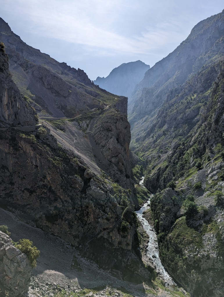
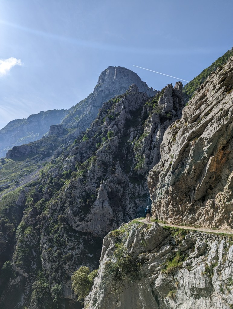
Among the Picos de Europa’s most famous hikes, the Ruta del Cares ranks near the top. Straddling the gap between the central and western massifs, it promises stunning views and precipitous cliff faces. Sign us up.
We got a later start, and so were able to take advantage of the hotel’s breakfast. As always, nothing starts before 8 (and usually 10), and always comes with a slice of ham. We were happy for the good fuel, though, as our hike started with a pretty stern grunt up high above the Río Cares.
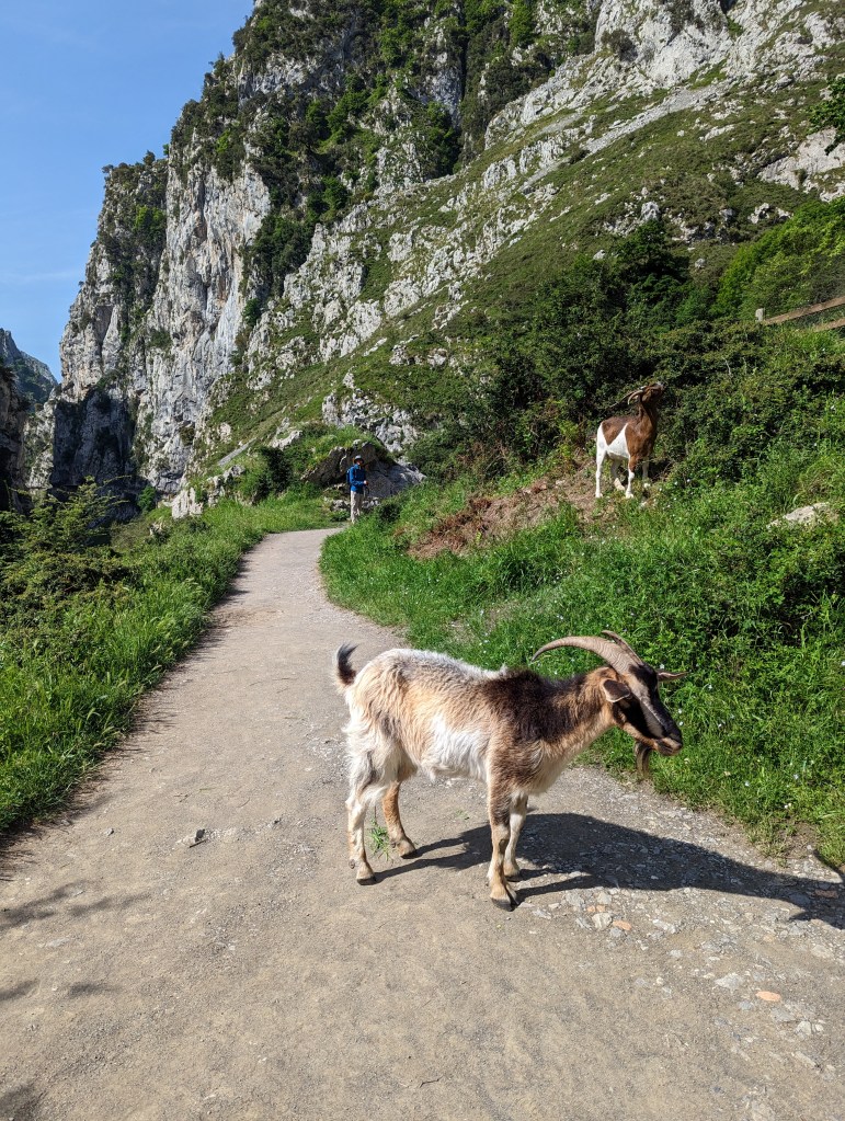
We passed ruined goatherd huts, and dozens of wild goats who peered sleepily down at us as we walked beneath their ledges. Occasionally they would meander along the path, munching the verging grass and we, respecting their very sharp horns, didn’t rush them.
I turned the turbo-boosters on to pass a group of people, and kept up a blistering pace that soon had us alone on the cliff face. And it really was a cliff face. At sections, the two-metre-wide trail had no buffer separating walkers from a vertigo-inducing drop. Or anxiety-inducing, in Ben’s case. In the end, we realized that when he was walking in front (and therefore couldn’t see me next to such a sheer drop) then all was well. At one point I sat cross-legged about a foot from the edge to get a picture and from behind me I just heard “I hate it I hate it I hate it.”
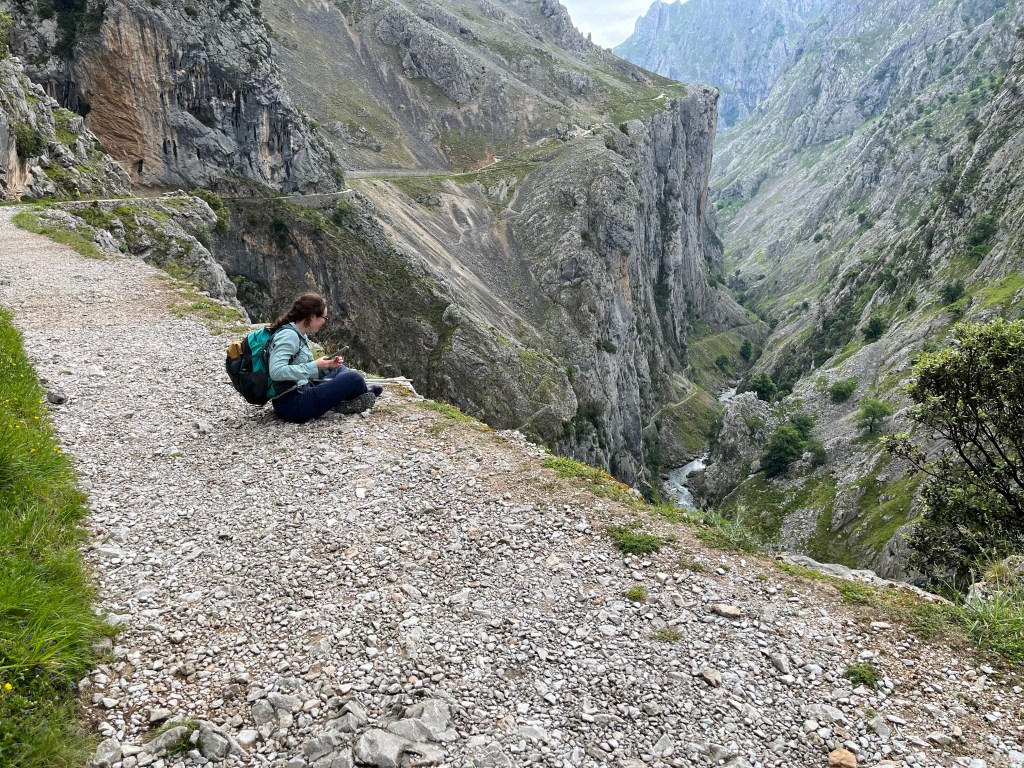
I hated it.
I wasn’t going to fall forward, over my crossed legs!
Telling myself that didn’t help. My brain just does not like seeing that much air around the woman in possession of our car key. Walking ahead, I was fine to be near the edge and peer over from time to time.
As we moved further from Poncebos and closer to Cain, the expansive views narrowed as the space between the massifs shrank. We started being able to hear the river. The hillsides started getting greener, and we passed through a number of tunnels.
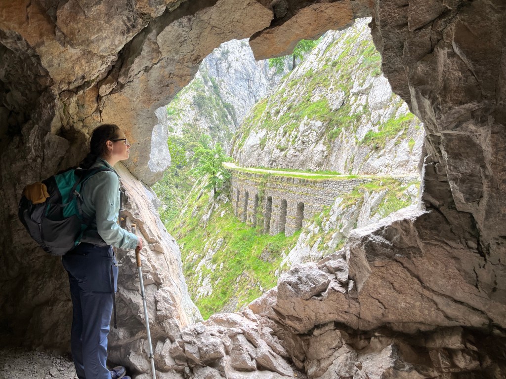
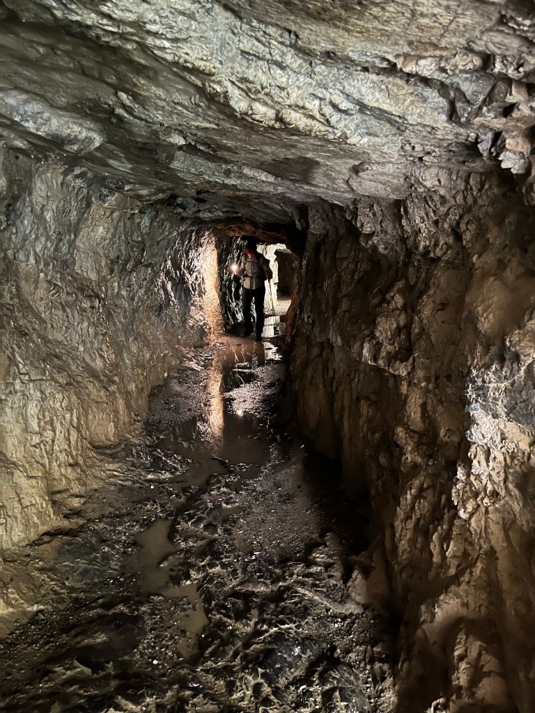
This path was built alongside a canal for shipping goods, mostly from mines, down from Cain to Poncebos. At times they merely created a flat track along the slope, but at many points they had to blast a path through sheer cliffs. There, the wall would lean over us, or even reach all the way down to enclose us. The tunnels also grew longer near Cain. In some, windows had been knocked out every few metres to let light in, but still there were long gaps of near pitch darkness. The ceiling drips filled puddles on the floor that we splashed into unexpectedly until we thought to use our phone flashlights.
Cats, sandwiches and increasingly urgent bladders awaited us in Cain. The thing about following a cliff-edge path for 11 kilometres is that there’s not really anywhere you can just pull off to pee. There are no bushes, there is only a solid wall of rock. And being a popular trail, you’re bound to be interrupted. So before we left, we knew we had to go. There were restaurants, but it’s customary for only patrons to use it (or walk-ins can offer a euro). But why be civilized when a tall-grassed meadow is right next door? I waded in, stomping through greenery as tall as my thigh, but found I was still quite within eye-line. Like a dog bedding down for the night, I tamped down a small circle, then squatted so low that grass tickled ass. Much relieved, I somehow managed to wipe (thanks pee-pad! If you know you know.) and pull up my pants while staying low.
Why… was that so detailed…?
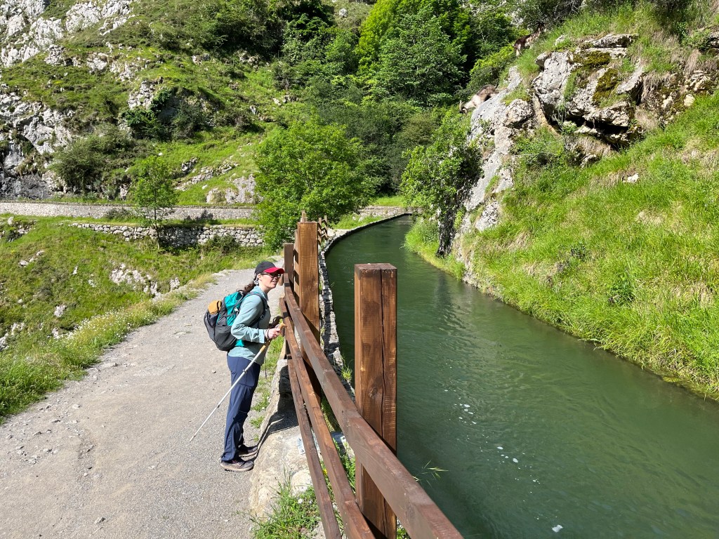
Sorry I’ll go back to describing the cute canal that kept disappearing and reappearing along the route. It was cute. I wanted to jump in the water. Ben said I’d drown.
For an out-and-back, the return journey offered a lot more new views than I was expecting. Just facing the other way let us really appreciate what a spectacular place it is all over again. We were pretty footsore by the time we got back to the car. Then it was a short hop around the eastern massif to our next hotel in the Liebana Valley. Sabrina had found her rhythm behind the wheel and was cruising, but so were the local police who tailgated us for maybe 30 seconds before pulling a pretty hairy pass and ripping off around the bend.
Evening light through the window. Distant bells. Rolling over in a squeaky bed.
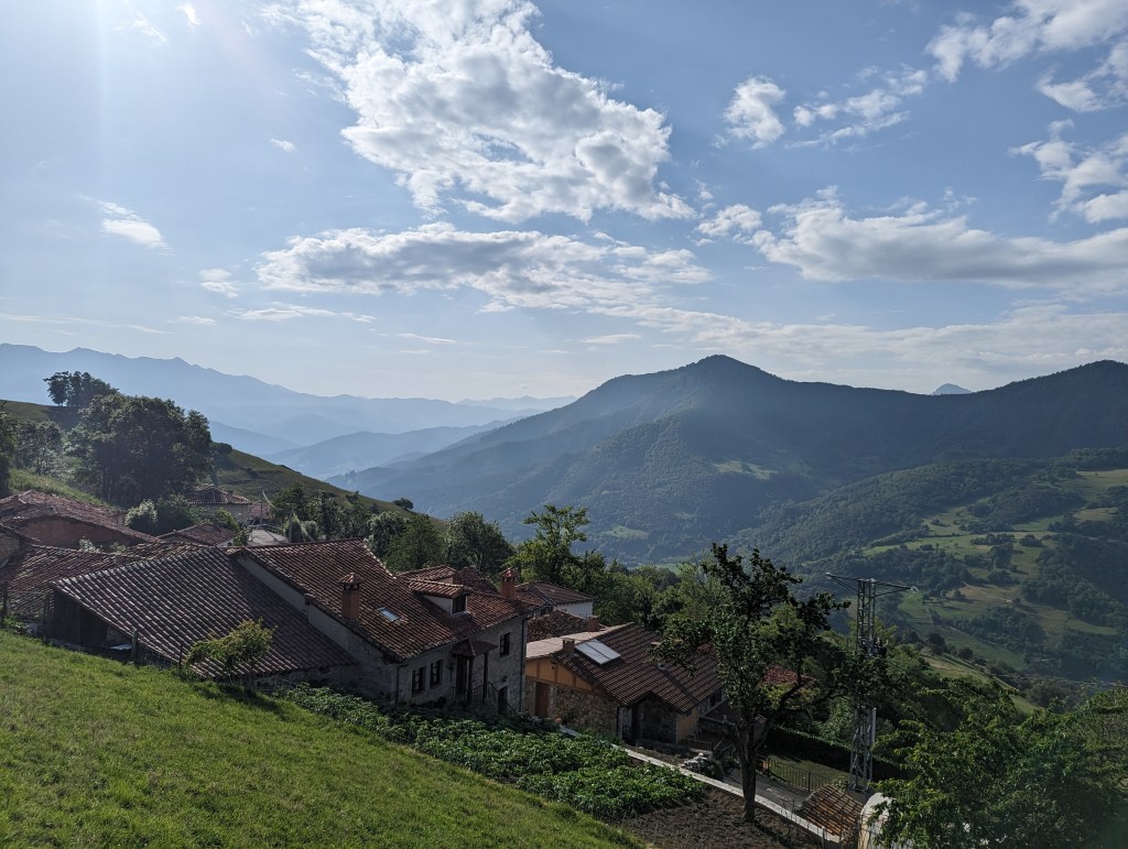
After two fairly intense days, we were like baby aliens learning to walk. Our calves were in dire need of a rest. So as hard as it is to lay low in a place like this, we took a rest day. Just a short 6km nearby walk with a measly 300m of gain. It still had amazing views of the eastern massif however, since we were able to drive a good chunk of the way up the mountain.
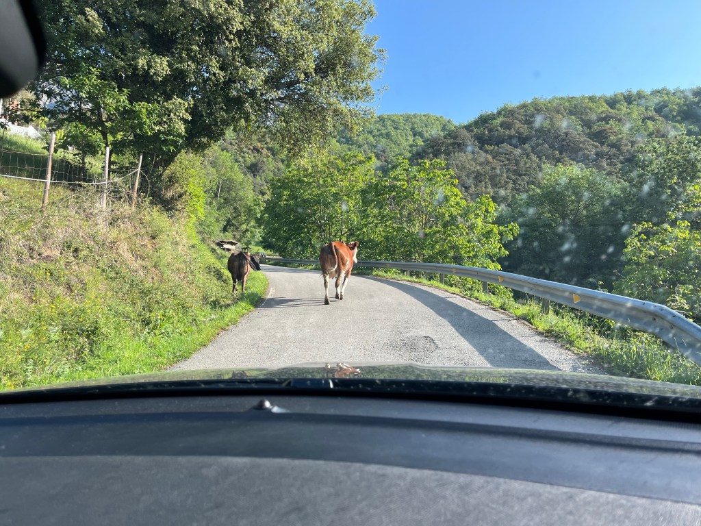
As we drove to the tiny town of Bréz, we managed to get ourselves involved in a mini cattle drive. Cows milled about on the road. We tentatively tried to nose through them, hoping they wouldn’t kick or swipe at the rental car. They weren’t bothered. One came ambling from the ditch right at our car. It was eyelashes away from the driver side mirror when I man with a long stick came hollering around the bend. The cow seemed to understand and turned around. The man shook his head deprecatingly as if to say, “you see these stupid animals I deal with?” And we shared a laugh through the windscreen.
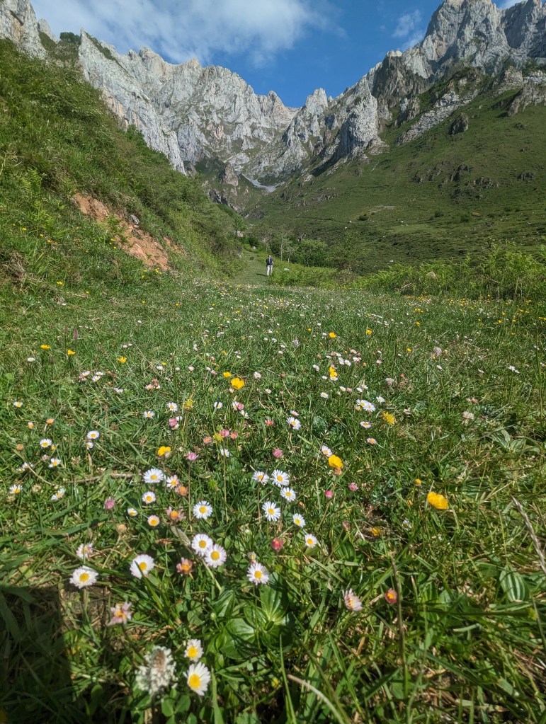
Obstacle cleared, we parked and sauntered through a lovely oak grove, passed a maintenance crew brushing weeds, and were suddenly in a high alpine pasture covered in wildflowers and cow pies. It’s what I imagine 90% of Switzerland must be like. All green meadow and mountain. We couldn’t resist.
Ohhhh what’s an extra little bit of elevation gain? We veered off route to explore up closer to the teeth of the mountain. The path was covered in tiny flowers like fairy lights guiding us upward. It was magical.
Just as magical? The magnificent Potes visitor information centre, which we went to next. It is basically a huge natural history museum with exhibits about the geology, biota, and human (pre)history. Sabrina made her way through at a reasonable pace. I’m a completionist in these places. I will read every sentence and examine every specimen, as if I am going to remember even a tenth of it by tomorrow. I took too long. Before I was halfway through, the howl of a school group began chasing me along. I was like those grouse that stand still until the predator gets too close, then flutters mere metres down the path over and over instead of just leaving the area. Finally I circled around behind them to complete my tour in peace. Sabrina, meanwhile was ensconced in the map room.
Happily and peacefully I might add. Can’t emphasize enough how preteen-free this map nook was. I pored over the 3D topographic maps seeing which way we should approach a particular high alpine valley we had our eye on. The Vega de Liordes is a steep, sustained and shaly climb to reach but Ben was confident we could do it. My calves were still tighter than his and I had reservations.
At 9pm, I suddenly had reservations too when, to make sure I knew what we were getting into, Sabrina read me the book description of this hike. It was then that I realized this was a totally different hike than I thought. Poor Sabrina! She has studied and planned and mapped these options for months, and her oafish husband can’t keep the Spanish names straight. So, sleepy as we were, we had to reconsider our plan for tomorrow. Luckily, this area has no shortage of wonderful things to see, and Sabrina was quickly able to narrow it down to two options, both of which would allow us a leisurely start.
I think this was all a ploy in order to not miss the hotel’s breakfast, which like everything, came with ham.

Leave a comment